
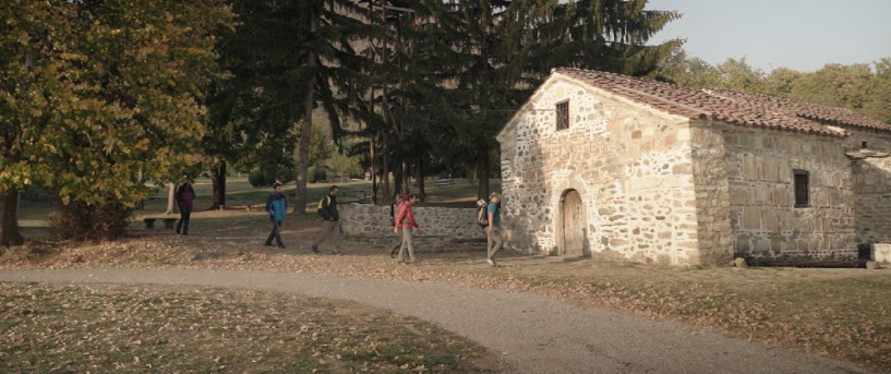


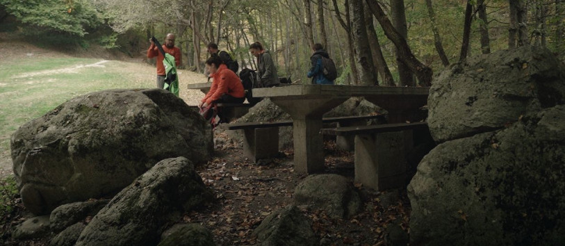


Points of interest
Trail No.2 Viola Trail - NMK
MOUNTAINEERING HUT “LJUBOTEN”
Location: Shar Mountain, above the Village of Staro Selo/ Ljuboten
Altitude: 1635 m.a.s.l.
Access: Unpaved road or marked mountaineering trail from the info board in the village.
Description: The Mountaineering Hut was built in 1931 and is the first and oldest Mountaineering Hut in the Republic of Macedonia. Below the hut there is a beech forest and visitors can enjoy the view of Polog, the peak Ljuboten, Kozja Stena, Livadica and Piribeg. The hut offers accommodation for 50 visitors, a shared dining room, a kitchen and the opportunity to try various traditional recipes. The hut is managed by the Mountaineering Club "Ljuboten" from Tetovo. The Mountaineering Hut is open on weekends during the whole year and with a prior notice it can also open during the week days.
GPS: N 42° 11’ 06.14’’ / E 21° 07’ 44.03’’
“DZANDARSKA BUKA”
Location: Shar Mountain, Ljuboten
Altitude: 1670 m.a.s.l.
Access: Marked mountaineering trail from the Mountaineering Hut “Ljuboten”.
Description: A characteristic place only 20 minutes away from the Mountaineering Hut "Ljuboten". A pasture area on which, outside the forest belt, stands one old beech tree, which in the warmest summer days provides great shade. It is called "Dzandarska" because in the past near the present hut there was a gendarmerie. The police who served in this watchtower often spent their lunch and rest time under this beech tree, and thus the tree is named "Dzandarska Buka".
GPS: N 42° 11’ 21.77’’ / E 21° 07’ 17.79’’
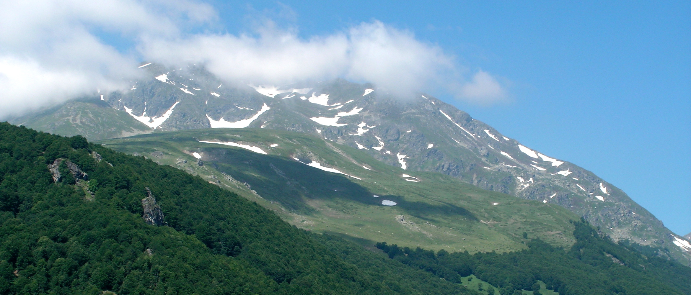
“KOZJA STENA”
Location: Shar Mountain, Ljuboten
Altitude: 2100 m.a.s.l.
Access: Marked mountaineering trail from the Mountaineering Hut “Ljuboten”.
Description: "Kozja Stena" is a limestone rock that protrudes on the southern part of the peak Ljuboten. The rock itself, the stone area and the peak give character to the landscape on the southern slope of the peak Ljuboten. This rock is also called "Dzinovski Zab" (Giant Tooth). The name "Kozja" (Goat) is due to the presence of the wild goat in this part of Shar Mountain. West of the rock is the highest mountain spring in this part of Shar Mountain. This stone area is the largest limestone area in Macedonia.
GPS: N 42° 12’ 11.52’’ / E 21° 06’ 52.51’’
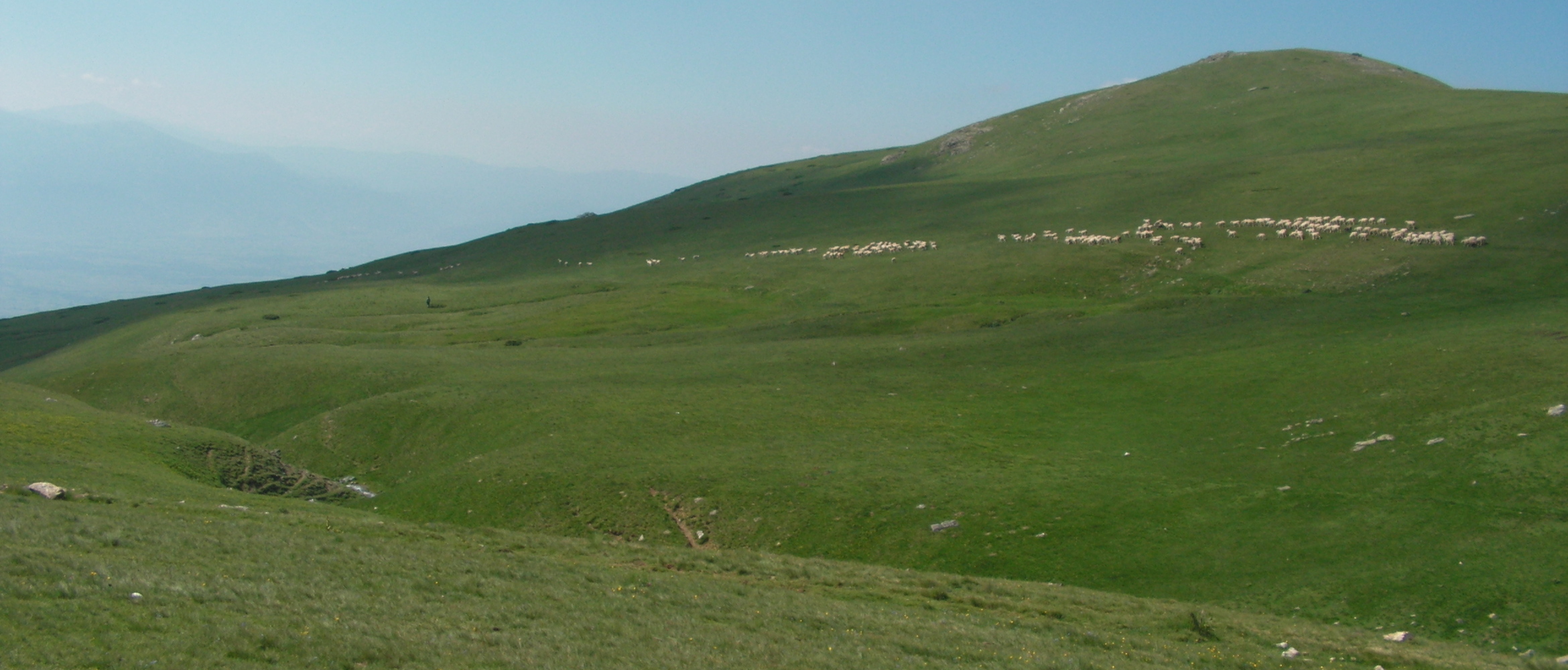
BEKIM’S SHEEP FARM
Location: Shar Mountain, Gradska Livadica
Altitude: 1700 m.a.s.l.
Access: Marked mountaineering trail from the Mountaineering Hut “Ljuboten”.
Description: Bekim's Sheep Farm was named for its owner Bekim, from Tetovo. It is an active Sheep Farm that operates in the period from July to September. What is significant for this place is that there is a summer garden built for visitors in the Sheep Farm. When visiting the Sheep Farm you will be offered young white cheese, yogurt, homemade bread and tea.
GPS: N 42° 11’ 11.65’’ / E 21° 06’ 22.80’’
PEAK LJUBOTEN
Location: Shar Mountain, Ljuboten
Altitude: 2499 m.a.s.l.
Access: Marked mountaineering trail from the Mountaineering Hut “Ljuboten” to the peak.
Description: Peak Ljuboten is the starting point of the massif Shar Mountain. As one of the highest peaks, it stands out and represents the most dominant point of the whole massif. It is one of the most explored and most climbed peaks on the Shar Mountain. The peak is characterized with the ridge that is the only one of this kind (Alpine) on Shara, especially pronounced in the winter period.
GPS: N 42° 12’ 24.27’’ / E 21° 07’ 09.39’’
LAKE “LIVADICHKO EZERO”
Location: Shar Mountain, Livadica
Altitude: 2210 m.a.s.l.
Access: Marked mountaineering trail from the Mountaineering Hut “Ljuboten” to the lake.
Description: The Lake “Livadichko Ezero” is one of the largest glacial lakes on the Shar Mountain, 228 meters in length and 120 meters in width. The sight that visitors can enjoy in is its clear water and the dominant peak Ljuboten in the background. The color of the lake is greenish, and where it reaches the greatest depth of 7 meters it is dark blue. Not far from the lake is the peak Livadica, at a height of 2480 meters.
GPS: N 42° 11’ 21.88’’ / 21° 04’ 28.77’’
LAKE “VRATNICHKO EZERO”
Location: Village of Vratnica
Altitude: 655 m.a.s.l.
Access: Unpaved road from the village of Vratnica to the lake.
Description: The Lake “Vratnichko Ezero” is an artificial lake built on the locality "Golina" in the 1960s. The lake served for sports fishing. The surroundings in the past were arranged for picnics and camping. Today the lake does not serve the same function as it did in the past, but it is worth visiting and experiencing the panorama of the lake and the peak Ljuboten in the background.
GPS: N 42° 07’ 17.36’’ / E 21° 07’ 36.23’’
PICNIC AREA “PETACHKO VODICHE”
Location: Village of Belovishte
Altitude: 860 m.a.s.l.
Access: Asphalt road from the village of Belovishte.
Description: Above the village of Belovishte there is a picnic place named "Petachko Vodice". At this spot there is also one small church St. Petka and a spring of water rich in iron, which is believed to be benefical for the health of the eyes. This place is a great picnic spot. Only 5 minutes above this place there are several small waterfalls on the Belovishka River, from which the most famous one is the so-called "Vrazhji Vir". Near the picnic place there are several fishponds and restaurants.
GPS: N 42° 08’ 43.93’’ / E 21° 05’’ 55.47’’
PICNIC AREA “KALUGJER”
Location: Village of Rogachevo
Altitude: 955 m.a.s.l.
Access: Asphalt road heading to the watchtower at the end of the village.
Description: Only one kilometer away from the village of Rogachevo is the locality "Kalugjer". Here we can visit the spring that has the same name as the locality and also the church "St. Ilija". The place is arranged as a picnic area with a large number of tables and benches. An interesting place to visit on warm summer days, for family outings and socializing.
GPS: N 42° 09’ 44.11’’ / E 21° 09’ 26.99’’
GET YOUR MOBILE APP
 |
 |
||
 |
 |
 This web has been produced with the assistance of the European Union. The content of this web is the sole responsibility of the implementing organisations and can in no way be taken to reflect the views of the European Union.